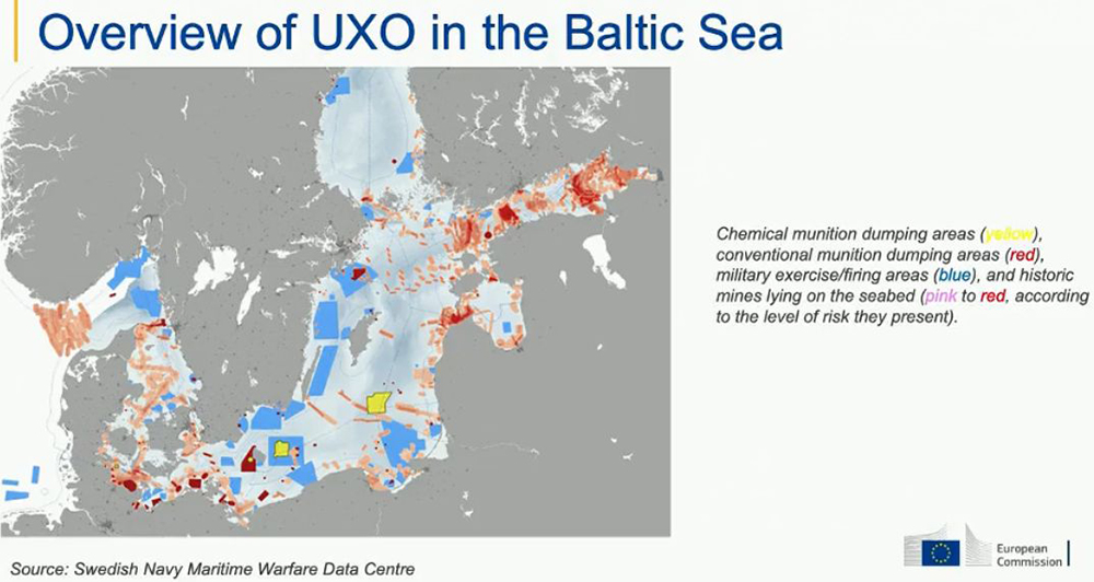
Assessing historical data and maps, accompanied by state-of-the-art methods to map the sea floor and detect munitions objects, is a key capability for success. Processing and analysing data are constantly being further developed, both with respect to processing speed and when it comes to a more objective detection of potential munitions objects using AI and cloud computing.
Classic mapping methods, such as acoustic, optical, and magnetic techniques are also further being refined to achieve higher resolution and accuracy. These are increasingly integrated with computer-driven technologies, including artificial intelligence, enhanced data management, and data-integrating interpretation procedures.
